Trail Walking Le Dévoluy - Cascade de Saute Aure - Photo
© OpenStreetMap contributors
Length
Length
7.7 km
Max alt
Max alt
1583 m
Uphill gradient
Uphill gradient
227 m
Km-Effort
Km-Effort  
10.8 km
Min alt
Min alt
1383 m
Downhill gradient
Downhill gradient
227 m
Boucle
Boucle
Yes
Creation date :
2014-12-10 00:00:00.0
Updated on :
2014-12-10 00:00:00.0

(3 Reviews)

Walking
Walking
3h01
Difficulty : Easy

Scan this QR Code to open this trail in the SityTrail application

FREE GPS app for hiking

Logo SityTrail SityTrail

IGN / Geographical institutes

Download SityTrail from the App Store Download SityTrail from Google Play

Logo SityTrail SityTrail World

The world is yours!

Download SityTrail from the App Store Download SityTrail from Google Play Download SityTrail on Huawei AppGallery

About

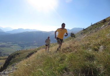
Trail Walking of 7.7 km to be discovered at Provence-Alpes-Côte d'Azur, Hautes-Alpes, Le Dévoluy. This trail is proposed by marmotte83.

Description

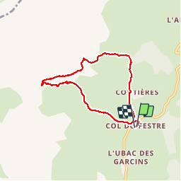
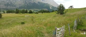
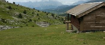
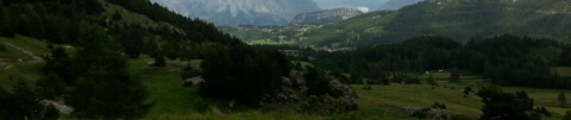
Boucle depuis le col de Festre.
Montée dans les alpages, progression très facile. Cette balade empreinte un sentier PR "sentier de découverte du devoluy". Marche très accessible en famille. Vous rencontrerez des troupeaux de brebis. Arrivée au plus haut à la cabane de la Rama. La descente vous fera découvrir une source rafraichissante.

Elevation profile

Photos

Points of interest

Point of interest Le Dévoluy - Point 1 - Photo
marmotte83
LE DÉVOLUY 
Point of interest Le Dévoluy - Point 4 - Photo
marmotte83
LE DÉVOLUY 

Positioning

Country:
France
Region :
Provence-Alpes-Côte d'Azur
Department/Province :
Hautes-Alpes
Municipality :
Le Dévoluy
Location:
Agnières-en-Dévoluy
Start:(UTM)
726520 ; 4949867 (31T) N.

Comments

Please log in to post a review or rate the element


Trails nearby

Trail Walking Le Dévoluy - R13   Le Col de Lauteret - Photo
Walking
GUIDE+

Walking

Medium
(1)
Le Dévoluy, Provence-Alpes-Côte d'Azur, Hautes-Alpes, France
8.5 km | 15.9 km-effort
3h 12min
Yes
Trail Walking Le Dévoluy - R12   Le Col des Aiguilles - Photo
Walking
GUIDE+

Walking

Medium
(1)
Le Dévoluy, Provence-Alpes-Côte d'Azur, Hautes-Alpes, France
10.2 km | 19.2 km-effort
3h 56min
Yes
Trail Walking Le Dévoluy - R11   Cabane Rama - Photo
Walking
GUIDE+

Walking

Very easy
(4)
Le Dévoluy, Provence-Alpes-Côte d'Azur, Hautes-Alpes, France
5.5 km | 8.4 km-effort
1h 46min
Yes
Trail Running Le Dévoluy - Trail 02 - Le Chauvet par le vallon des Aiguilles - Photo
Running
GUIDE+

Running

Difficult
Le Dévoluy, Provence-Alpes-Côte d'Azur, Hautes-Alpes, France
8.3 km | 17.1 km-effort
1h 30min
Yes
Trail Mountain bike Le Dévoluy - VTT16 - Boudelle - Photo
Mountain bike
GUIDE+

Mountain bike

Difficult
Le Dévoluy, Provence-Alpes-Côte d'Azur, Hautes-Alpes, France
18.9 km | 30 km-effort
1h 51min
Yes
Trail Walking Le Dévoluy - R21   L'observatoire de Bure depuis la Joue du Loup - Photo
Walking
GUIDE+

Walking

Difficult
Le Dévoluy, Provence-Alpes-Côte d'Azur, Hautes-Alpes, France
11.9 km | 21 km-effort
4h 21min
Yes
Trail Walking Le Dévoluy - le grand Ferrand  Devoluy - Photo
Walking
tchoua

Walking

Very difficult
Le Dévoluy, Provence-Alpes-Côte d'Azur, Hautes-Alpes, France
16.5 km | 35 km-effort
4h 50min
Yes
Trail Walking Le Dévoluy - Le chauvet - Photo
Walking
Vero7684

Walking

Difficult
Le Dévoluy, Provence-Alpes-Côte d'Azur, Hautes-Alpes, France
14.7 km | 28 km-effort
6h 12min
Yes
Trail Walking Le Dévoluy - cabane col des Aiguilles La Jarjatte  - Photo
Walking
Atchoum26

Walking

Difficult
Le Dévoluy, Provence-Alpes-Côte d'Azur, Hautes-Alpes, France
12.8 km | 21 km-effort
5h 32min
No


Close
My subscriptions